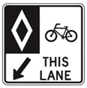
Indicates that lanes are reserved for use by bicycles only.
This website uses cookies to enhance usability and provide you with a more personal experience. By using this website, you agree to our use of cookies as explained in our Privacy Policy.
The health and safety of residents is a key priority for the City of Brantford and the primary objective of implementation of the City's Vision Zero initiative that focuses on safety, education and the wellbeing of all citizens and visitors. Establishing and communicating the rules of our roads and trails is an important step in preventing accidents and injuries.
All users of the road must follow these rules:
Respecting rules and etiquette on trails will help avoid conflicts or injuries so everyone can enjoy trails equally and safely.
Indicates that lanes are reserved for use by bicycles only.
On-street with contra-flow bicycle lane, cyclists are permitted to travel in both directions while motorists are restricted to one direction only. Cyclists travelling in the opposite direction of traffic (or “contra-flow”) must use the designated lane provided.
Turning Vehicles Yield to Bicycles Sign
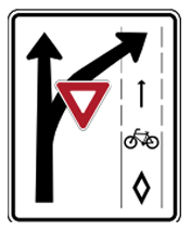
This sign is used at intersections where motorists permissively turn across a cycling facility and are required to yield to the cyclist that might be going straight.
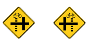
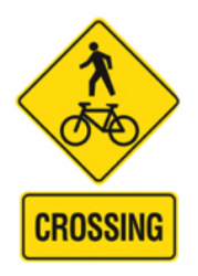
Bicycle Path Crossing Side Street Sign
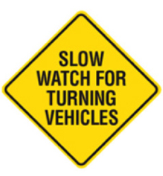
Slow Watch for Turning Vehicles Sign
The City of Brantford has designed a new system of wayfinding signs that will be installed throughout the City on the on-road active transportation routes. These signs highlight safe routes for both cyclists and pedestrians and provide information about nearby destinations.
Wayfinding signs will create a greater level of legibility and understanding of the on-road active transportation network and will assist both residents and visitors in easily navigating their way to major points of destinations in the City. Some of these destinations include City-owned facilities, community centers, parks, schools, Brantford Hospital, Brant Conservation Area, Lynden Park Mall, and other cycling- and pedestrian-friendly routes.
These signs will initially be implemented on the following seven core active transportation corridors in the City:
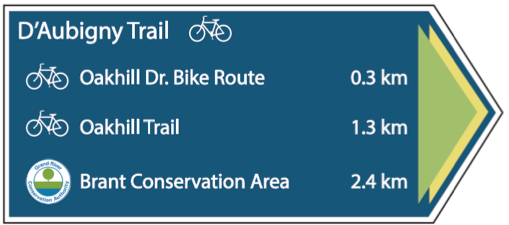
Be sure to look for the new signs when cycling and walking around the City.
Contact Us
City of Brantford
58 Dalhousie Street
P.O. Box 818
Brantford, Ontario
N3T 2J2
Subscribe to receive updates from the City
Stay up-to-date on the city’s activities, events, programs and operations by subscribing to our newsroom.

Register or Pay

Contact

