Colborne Street Slope Stabilization
Background
In 1986, a major landslide event occurred on the slope along Colborne Street in the City of Brantford, in a section adjacent to the Grand River in the area known as ‘the Oxbow’. This area is located north of the Grand River between Clara Crescent and Johnson Road, and also includes the Hamilton-Brantford Rail Trail, located along the former Canadian Pacific (CP) Railway. The landslide led to the destruction of the CP rail line and prompted the evacuation of several residents with properties along Colborne Street.
Since the landslide in 1986, several studies have been completed to determine cause and effects, and monitoring shows that slope movement continues to occur. The investigations have consistently concluded that the mechanism of failure was a combination of over-steepening of the slope due to erosion and undercutting at the toe of the slope by the Grand River, coupled with high groundwater levels within the slope which compromised the cohesiveness of the soils.


The Municipal Class Environmental Assessment Study
In 2020 The City of Brantford completed a Municipal Class Environmental Assessment (EA), Schedule “C”, to develop feasible alternatives for addressing the slope stability concerns.
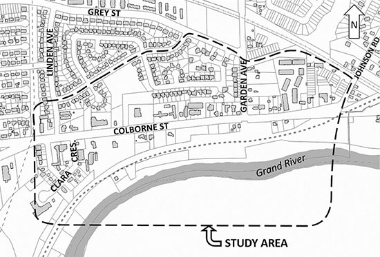
The study area included approximately 1,200 metres along Colborne Street between Linden Avenue and Johnson Road, including the embankment extending to the Grand River.
Public Consultation
Three Public Information Centres were held to provide interested parties with an opportunity to review and discuss issues related to the project. The first PIC was held on September 13, 2018. The second PIC was held on March 12, 2019. The third and final PIC was held on November 13, 2019.
The Report
The Final Environmental Assessment Report for the Colborne Street East Slope Municipal Class Environmental Assessment Study is now available.
Detailed Design Phase
The City of Brantford is currently in the detailed design phase of the site stability solution, as recommended through the Class EA process. The stabilization design includes the following elements to be implemented:
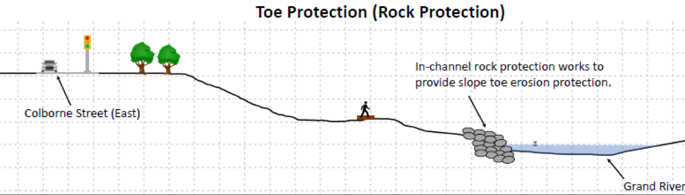
- Installation of rock toe protection along the Grand River to prevent erosion and undercutting at the toe of the slope;
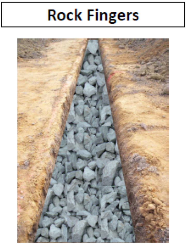
- Installation of rock fingers (tied into and extending up from the toe protection) to facilitate draining of the lower slope and lowering of the shallow groundwater table to the fullest extent possible;
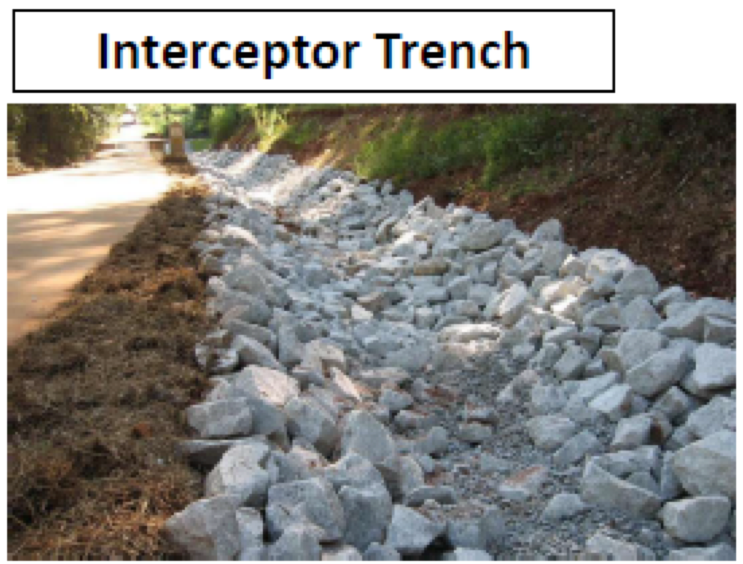
- Installation of an overland flow/drainage strategy including collection trenches, slope drainage pipes, and culverts under the existing rail trail;
- Continued topographical, groundwater, and inclinometer monitoring, including building upon the baseline Light Detection and Ranging (LiDAR) topography.
As part of a second phase, Installation of a lower slope rock ballast as a form of mechanical stabilization. This second phase cannot commence until the groundwater table is successfully lowered through the above-noted actions. If the slope movement is minimized through the above-noted efforts, the lower slope rock ballast may not be required. The installation of the mechanical stabilization will be determined through additional monitoring and modelling.
Construction Phase
Construction has been delayed until 2025 due to permitting requirements and sensitive environmental timing windows. The City of Brantford now anticipates construction to begin in late 2025, with completion expected by middle of 2026.
The Project Team
If you have any questions about this project, please contact us using one of the following methods:
- By Mail – please mail to City of Brantford Environmental Service Admin Building, Attn: Adam Quibell, City of Brantford, 324 Grand River Avenue, Brantford, ON N3T 4Y8
- Phone – please contact the City at 519-759-4150 Ext. 5266
- By E-mail – please contact the Project Team
Subscribe to receive updates from the City
Stay up-to-date on the city’s activities, events, programs and operations by subscribing to our newsroom.


